Misconceptions of Real-Time Ocean Surface Measurements and How the Reality Saves a Bundle
There are lots of questions – and misconceptions – about vessel performance reporting in the shipping and maritime industries. The manually produced “noon report” – a daily data sheet prepared by a vessel’s captain – logs the vessel’s position and other relevant standardised data. Like most manual processes, however, these are subjective, time-consuming and prone to human error. Yet many business decisions that propel the industry forward are based on noon report insights. Real-time ocean surface measurements are turning the tide on this unrefined practice.


When it comes to noon reports, there are several burning questions as to their efficacy in the present day. The idea that multiple industries are guided by readings taken only every 24 hours is a shocking reality. In an age where connectivity, immediacy and accuracy are regarded as norms – not luxuries – one has to wonder if noon reports are sufficient. Real-time ocean surface measurements, available in the palm of your hand, surely, are the 21st century’s answer.
The Big Questions About Noon Reports
- Do they make sense in this fast-moving, dynamic era?
- Can noon reports reflect the performance of a vessel accurately?
- Can they indicate when a vessel is in need of repair or maintenance?
- Should key chartering decisions about a vessel’s efficiency be based on averages gleaned from only 24 hour periods?
- Can the data that is reported be trusted (after all, inaccurate or deliberately false reporting is certainly possible, if not verifiable)?
For ship owners and operators, accurately answering these questions means tapping into the growing potential for real-time data analysis. Optimising operational decisions and satisfying the increasing number of economic demands and industry regulations is a rising priority. Particularly when environmental incentives are at stake too.
Real-Time Technology for Real-Time Efficiency
With new technologies on the rise, real-time measurement, automation and data are converging. In doing so, they are actively combating long-held misconceptions and objections that have, in some cases, kept the industry from moving forward at the speed it should. Here are just a few of the common false assumptions:
- Real-time ocean surface measurements are impossible from a moving vessel
- The accuracy of real-time, moving-vessel measurements isn’t sufficient
- Real-time monitoring and assessment equipment is either too expensive upfront, too expensive to maintain and calibrate, too complicated to install – or all of the above.
These statements simply don’t reflect the reality.
Moving past Misconceptions: Real-Time Ocean Surface Measurements
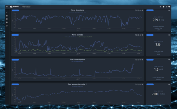
Miros’s Wavex system offers the ability to integrate real-time ocean surface measurements into noon reports – eliminating human error and misreporting. Furthermore, this couldn’t be easier to implement. Within just two or three days, onboard commissioning and testing is complete, and the resulting solution is practically maintenance free. There is no need for manual calibration, and no wet equipment whatsoever.
Adding up-to-date insights to noon reports is only the beginning. Incorporating today’s cutting-edge technology, as well as the potential of IoT, you can use the measurements you gather to save fuel, gain operational and environmental efficiencies, reduce weather damage to cargo and the vessel, boost the accuracy of hull-stress monitoring, get more accurate speed through water measurements, predict more precise ETAs, and so much more. There are surely use cases we haven’t even foreseen.
Are you grappling with outdated ways of gathering noon report data? Perhaps you’re curious as to what this technology can do for you? If so, don’t hesitate to have a conversation with us about how our solutions for real-time ocean surface measurements can help you gain operational efficiencies.