Why it matters where you measure your waves
Waves are random and, in most contexts, it is complicated and not meaningful to describe them precisely. Measurement techniques may make a big difference, measuring around structures or in shallow waters with varying bathymetry, can result in substantial variations. However, differing results may not necessarily be wrong.


A brilliant client told me that “if you have one wave measurement, the data is correct, and life is sweet; if you have two measurements, you have two wrong measurements”. He had five sensors in the same area of operation: one only measuring waves; the other four mainly measuring airgap, but also waves; and all five delivered different wave heights. The funny thing is that all five measured correctly.
Waves are random and, in most contexts, it is complicated and not meaningful to describe them precisely. Traditionally, statistics are used to simplify the description of a sea state. This procedure is well established, and everyone gets the same understanding of significant wave height and peak period.
So why are our client’s five measurements all different, but accurate?
Some of it can be explained by the main assumption that the sea state is uniform in space and time. Even though various measurement techniques calculate in different ways, they all gather data for approximately 20 minutes at a time. This provides a good enough representation of all the waves, but limits the estimates to wave periods of 30 seconds or less.
Some sensors analyse continuously while others do it once an hour or even less frequently. If there are differences between the measurement periods, the result will also differ.
The area sampled, whether it is a single point or a large water body or surface area, also makes a difference in terms of measurement techniques. When measuring around structures or in shallow waters with varying bathymetry, this can result in substantial variations in terms of estimates. Although the results are not the same, they might not necessarily be wrong – they are just based on different information.
Read also: Why subscribe to ‘as-a-service’ over sensor hardware?
The biggest source of variation in measurements is where you measure the wave
To measure the typical sea state for an area, a uniform, unobstructed and fully developed sea is ideal. This was the reason for my client’s five different, but correct measurements. One sensor was measuring a hundred meters from a massive structure while the other four were sitting on each side of this structure providing airgap measurement with wave height data as a by-product.
Since our source was the remotely located sensing device, we could claim that this was the best measurement. But did our device give a correct description of the forces working on one particular side of the structure or did the sensor, placed at this particular location, actually deliver better measurements? Regardless of measurement technique and sensor brand, the devices simply describe what they see, and you need to consider this to make any meaningful use of the data.
Many operations offshore are obliged to follow a working limit connected to wave height to ensure safe conditions and avoid any potential damages which can be expensive. Accurately measured waves allow for increased workability within those strict safety margins as opposed to solely operating based on forecasts. While projections are great, they might provide more limiting assumptions than real time data giving, for example, only one estimate for an area sometimes tens of kilometres in grid size.
Read about Giants, Freaks and Monsters: The Wild World of Rogue Waves
Are different estimates a problem or opportunity?
Experienced offshore operators often locate their vessels to dampen waves and protect the working area. However, the aimed shielding effect can only be quantified and documented with a precise wave measurement on both sides of the vessel. Unfortunately, the vessel positioning is often based on limited knowledge of actual wave direction. Visually, you can see peak directions, but with multiple waves from different directions, a full directional spectrum is needed. Multiple sensors, smartly placed to measure the right areas in real-time enable these operations to safely take place in even rougher conditions, as the working limit is adjusted to the forces caused by the waves at the relevant location.
Turning real-time sea state data into actionable information for critical operational decisions
You could assume we would like to sell as many sensors as possible. For us, however, is it eminently important to create the best operational value so that any offshore operator or wave data analyst can make better decisions based on the data we provide.
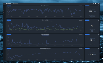
To enable that, the relevant data must be actual, accurate, and reliable as well as easily accessible in a sorted and structured manner, which is all set in the applications offered in Miros’ cloud service –miros.app.
Get in touch to share your thoughts. Do you think there are other considerations that should be discussed?