Case Study: Real-time wave measurements to reduce risk and save cost for the channel deepening project at the port of Lyttelton in New Zealand
Miros’ RangeFinder sensors reliably measure with millimetre accuracy in all weather conditions providing a greater understanding of the tide and long wave occurrence. The sensors helped minimise the capital dredging requirements through accurate modelling of under keel clearance and enabled safer and more efficient shipping operations at the Port of Lyttelton.
- Product: Miros Cloud, RangeFinder
- Type: Case Studies
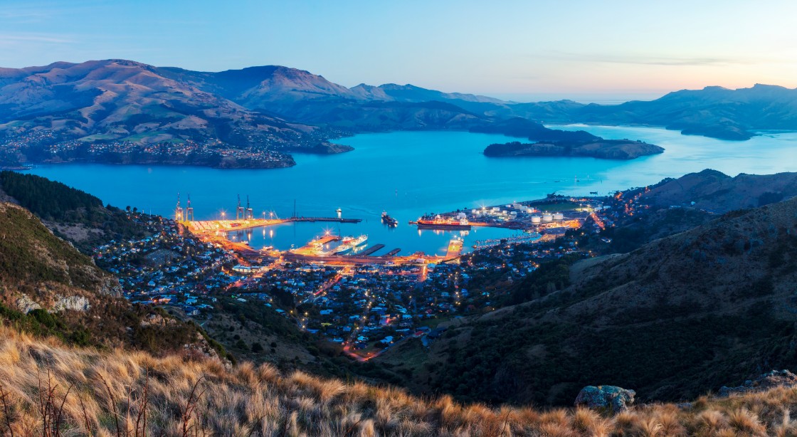


Image: Lyttelton Port Company
To download this case study, click here.
Background
Over the last decade, the size of container ships internationally has doubled. To accommodate larger vessels, the Lyttelton Port in New Zealand undertook the most comprehensive redevelopment project in its history.
The deepening project will lengthen the 7km shipping channel by 2.5km and widen it by 20m to increase maximum vessel drafts (the vertical distance between the waterline and the bottom of the vessel’s hull) from 12.4m to more than 13.3m to allow for larger and deeper ships.
The Challenge
Water level variations in Lyttelton harbour are known to be complex1. The fluctuations are the result of tide, wind-driven waves, swell, tidal surges, and long waves covering a wide range of frequencies which may differ greatly in space and time. Infragravity waves are especially a threat to the safety of operations and transit in most harbours; these long waves are difficult to dampen by port protective structures, such as dykes or breakwaters, due to their large wavelength. Once they enter a harbour, they can be amplified and excite semi-closed port basins and/or cargo-type moored vessels.
Such phenomena are an issue to port operations and the Port of Lyttelton, the largest port on the South Island of New Zealand and crucial gateway for the region, is no exception. Several times a year, infragravity waves above the commonly accepted minimum of 0.1m affect vessels in Lyttelton.
The port authorities in Lyttelton needed to better understand the wave patterns in order to mitigate the risk for port operations and to reduce the volume of dredging needed. Hence, the port authorities decided to upgrade the port’s entrance channel with wave measurement sensors.
The Solution
The port implemented Dynamic Under Keel Clearance (DUKC®) technology which uses precise measurements and modelling of waves, currents, tides, and ship motions to provide the best possible sailing advice for each vessel transiting the new entrance channel.
To accurately measure the complex water level fluctuations, two Miros RangeFinders were installed at strategic locations – one at the port entrance channel and one in the sheltered inner harbour basin. The captured wave movements were then combined with numerical and empirical modelling to establish simultaneous wave measurements. These equations, fed with forecast offshore wave conditions, provided reliable estimates of the operational long wave climate at sites within the port.
The RangeFinder, in contrast to other pulsed radar gauges available in the market, is based on a frequency modulated continuous wave approach that allows internal sampling of the distance to the water surface at up to 200Hz and reporting of results at up to 50Hz.
From the port’s experience, this high data rate is extremely helpful for discarding erroneous observations and providing reliable output at the frequencies required to resolve surface waves (2-4Hz).
The Results
Miros’ RangeFinder sensors can reliably measure with millimetre accuracy in all weather conditions, thus providing a greater understanding of the tide and long wave occurrence. The sensors helped minimise the capital dredging requirements through accurate modelling of under keel clearance and enabled safer and more efficient shipping operations at the Port of Lyttelton.
Better management of transit risk for daily shipping operations relies on detailed science-based calculations, considering the latest measured tide and wave conditions, high-resolution forecasts, and state-of-the-art vessel motion modelling.
The tool enabled improved scheduling of maintenance dredging which in turn also reduced project duration, ensured minimal impact on vessel accessibility to the port, and mitigated the project’s environmental impact.
The Value
Lyttelton Port Company decided to continue with the DUKC optimised channel design after performing a cost-benefit analysis, as well as to implement an operational DUKC system. This decision was based on a notable reduction in operating risk and a significant saving in capital expenditure.
By enabling larger ships to call at Lyttelton Port, local importers and exporters get the best possible and most cost-effective international shipping solution, with container vessels able to carry up to 5,500-6,500 TEUs after the redevelopment work.
Whilst the initial channel design predicted a dredge volume of 9.7 million cubic metres, the DUKC optimised channel only required a dredge volume of 5.5 million cubic metres, a reduction of 4.2 million cubic metres or 43%, which resulted in a significant saving in capital expenditure and an ongoing reduction in operating risk.
To download this case study, click here.
References
1 – GORING (2009). Seiche in Lyttelton Harbor, Mulgor Technical Note, October 2009