Reading Time: 4 minutes

Case Study: Understanding the effect of waves on the floating Nordhordland Bridge in Norway

Miros’ RangeFinder measures airgap, tide, water level, draught, and waves, with millimetre accuracy. The precise measurements will highlight the influence of waves and tide on the Nordhordland bridge and their impact on the wind turbulence close to the water surface.

Image: Nordhordland Bridge by Erlend Spurkeland 

To download this case study, click here

Background

The Nordhordland bridge is Norway’s second longest road bridge, and one of only two long-span end-supported floating bridges worldwide, with a length of 1,614m. It was opened in September 1994 and crosses the Salhus fjord between Hordvik and Flatøy, North of Bergen.

The structure consists of a cable-stayed bridge with a span of 371m and a floating bridge of 1,243m, joined over a lowering box without side anchors. The bridge is 99m high to allow ship traffic.

To gain a deeper understanding of the effect of waves and winds on the floating structure of the Nordhordland bridge, a monitoring project was started in August 2021 and is scheduled to last for 12 months. The project’s goal is to provide environmental facts and insights that shall be used to develop the design groundwork for the planned floating bridge over the Bjørnafjord.

The Challenge

As part of the project to establish a ferry-free E39, the Norwegian Public Roads Administration (NPRA) is working on solutions for ferry-free connections across the fjords along the 1,100km coastal route between Kristiansand and Trondheim. The combination of water depths up to 550m and bridge lengths of up to 5 km make it impossible to build conventional bridges. Floating bridges and submerged tubular bridges are the only feasible ways of making a road link across such wide and deep fjords.

To achieve this, the NPRA needs to better understand the floating bridge’s response to acceleration, displacement and excitation sources such as wind, vehicle traffic, wave excitation, wave impact on wind turbulences and vibrations. Hence, the  Nordhordland bridge will be the perfect real-life testing environment.

It was necessary to design a test system able to provide highly valuable recordings, describing both the environment and the bridge response. First, statistical data representing the relationship between environmental factors and the response will be established. Furthermore, the measurements will serve as a starting point for establishing the modal parameters, which characterise the bridge behaviour in an easily interpretable manner and quantifying them according to the changes in environmental conditions. The continuous recordings can also be used for structural health monitoring. 

Numerous land-based civil structures have previously been instrumented for measuring response and environmental excitation, but structural monitoring surveys of floating bridges are not widespread.

The Solution

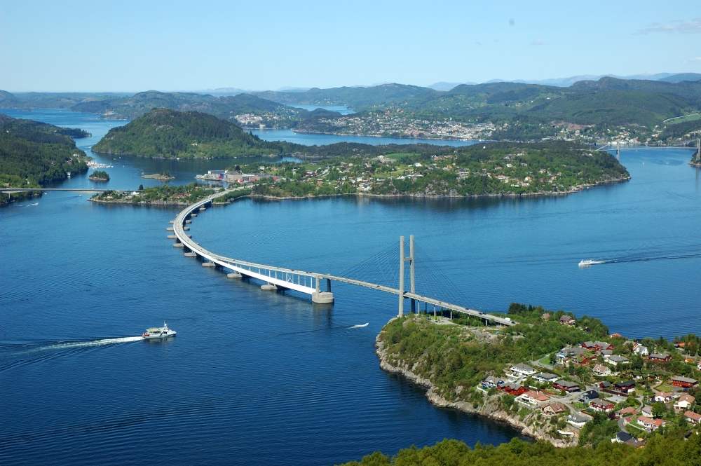
Volue Industrial IoT was commissioned by NPRA to provide 3D pontoon movement, wind speed, wave height, and water temperature measurements on the Nordhordland bridge. The gathered data will be used to improve the design basis for the bridge planned over the Bjørnafjord. This new floating bridge will be built over roughly 5km (3.1 miles) and suspended over a fjord that is 550m (1,804 feet) deep, at a cost of at least $1.3 billion.

As part of the work scope, Volue Industrial IoT installed different instruments to monitor the pontoons and the conditions under the Nordhordland bridge, with the information being relayed in real-time to the relevant authorities and stakeholders. In case of failure, the system alerts the bridge personnel so that emergency measures can be taken.

Miros’ RangeFinder sensor is included as part of the monitoring system. RangeFinder is a dry-mounted, radar-based sensor that measures airgap, tide, water level, draught, and waves, with millimetre accuracy in all weather conditions. The precise wave measurements will highlight the influence of waves and tide on the Nordhordland bridge and their impact on the wind turbulence close to the water surface. These detailed insights are crucial to optimise the design of the planned bridge over the Bjørnafjord.

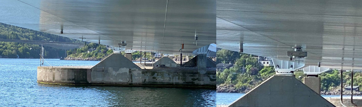
Miros RangeFinder installed under the floating structure of the Nordhordland Bridge. 
Image: Volue Industrial IoT

The Value

The relationship between environmental factors and the response of the bridge will provide important insight into the dynamic behaviour of floating bridges. Waves are assumed to be the main excitation acting on the bridge. However, both traffic and wind excitation will also contribute to the total response of the bridge. The collected data will be used to assess how the environmental parameters influence each other as well as impact the bridge response.

The monitoring project will provide crucial information for the planning and design of the future Bjørnafjord floating bridge. The gained insights will help to better validate models and calculate cost, to improve safety aspects while providing data to dimension the bridge properly. The data will help to better understand the response of the floating bridge on external factors and will support the optimal decision-making during the design phase of the new Bjørnafjorden floating bridge.

To download this case study, click here

Read more about our solution for the Ports & Coastal market.

Contact Us

We’re happy to help you with any questions about our products and services.